


Top of the South Cycle Tour
By Wayne Pool
Dilemma 1: we only had a five day window to ride, where do we go? We wanted it to be close to minimise driving time. Looking at a map of the top of the South Island a great loop leapt off the page: Drive to St Arnaud, ride the Rainbow Road, then across the Molesworth and Awatere Valley, over Taylor Pass to Blenheim and then up the Wairau back to the beginning! This was a total of 420kms and mostly on gravel roads with little traffic, through the largest farm station in the country.
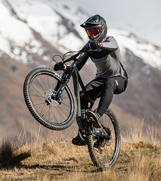
Dilemma 2: which bike do I ride? I had recently purchased new Thule touring gear from Torpedo 7 that would suit any sort of bike. So it was a choice between my super lightweight 20-speed carbon 29er racing mount or my rugged 20-year-old aluminium single speed. I had raced the Rainbow Rage so knew the climbing ahead and despite my fear that the lightweight carbon wasn’t designed to be a mule I opted for the 20 gears My partner, Gisela, didn’t have this dilemma – she was going to ride her heavy old hard tail with second-hand panniers.
Given the mixed weather forecast we needed to take warm clothing, as well as all our food, while keeping our weight to a minimum. We each had two panniers plus one additional dry-bag for the tent.
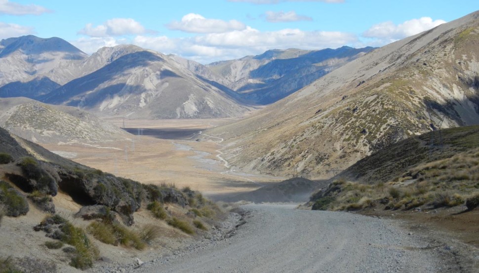
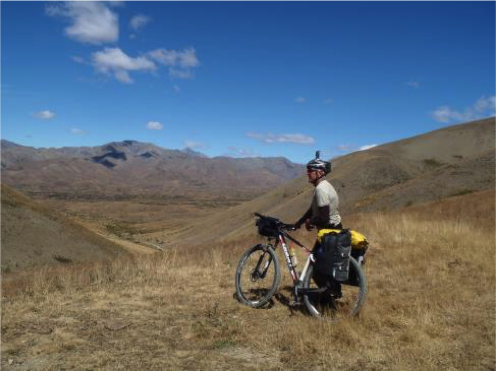
After an early drive to the Lake, we were off by 9am riding back up Highway 63 toward the Rainbow turn-off. The steady climb soon had us warmed up. Tarseal gave way to gravel at the ski field carpark where fog and drizzle gave the bush an eerie feel. We paid our small crossing fee at the farmhouse and continued up the valley. As the road kicked left between the Turk and Mangerton Ridges and the true climbing started, the clouds parted and sunshine appeared just as we reached Cold Water Creek campsite. Lunch was overdue and so was some maintenance on the carrier. Due to my reluctance to over-tighten the clamps on the carbon frame and the vibrations from the corrugations on the road, the carrier had been sliding down and rubbing on the tyre. This time my tightening went the other extreme and I snapped a clamp! My tool kit always includes duct tape, light rope and cable ties so soon the problem was addressed and lunch was eagerly completed. We zagged, then zigged up the now bush-bare, ruggedly beautiful valley toward Island Pass.
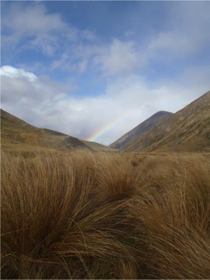
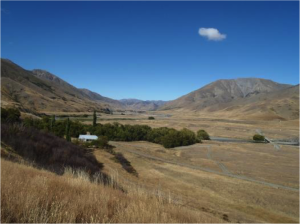
Rainbow on the Rainbow Road (headwaters of the Wairau River)
The speed at which we travelled linked directly to the condition of the road: when the surface was firm we hummed along but as it changed to coarse, loose gravel our velocity plummeted. The steep hills to our left ended, opening up a vista of flat, tanned valley contrasted by the stunning blue of Island, Fish and Sedgemere Lakes. A glance ahead indicated that the forecast may have been correct as menacing dark clouds rolled toward us. Just as we arrived at Sedgemere Sleep Out so did heavy rain.
Sylvain a tall French cycle tourist had the stove burning as he tried in vain to address his blown inner tube by cutting it in half and sewing each end. It was hard to believe he had attempted this trip without spares. Our spare tubes were of no use as they were the wrong size. Rudy from Motueka, who I had raced against many times, arrived in his campervan and came to the Frenchman’s rescue with a spare tube along with a cup of hot coffee. Two Aucklanders, travelling super light, peddled in from the other direction so it was looking like full accommodation for the night. The heavy shower ceased and although the ink dark cloud still hovered, Gisela and I decided to press on over Island Pass. It had cooled somewhat since the morning so winter gloves, beanies and leggings were donned.
As we tracked alongside the upper reaches of the Wairau River the dark cloud looked increasingly ominous. We made the decision to pull into Island Gully hut for the night. This turned out to be a wise move, firstly due to the snowfall that began an hour later and also because of the entertaining company we shared for the evening.
Tony and Paul, down from Wellington for the annual geese cull, accompanied by a couple of beautiful, long-haired Weimaraner dogs, shared their high quality bottle of whiskey along with their right wing version of the world. We suspect that their polemical conversation didn’t reflect their actual views but was ‘sport’ to try to rile the leftie, vegetarian, yogis sharing their hunters’ space for the night. The bottle emptied, the snow ceased, the debate agreed to disagree, the stove stoked for the night and we all slept well.
The previous night’s snowstorm proved to be a blessing. The bright blue sky, warm sun and surrounding snow-covered hills made for stunning riding over Island Pass and down to Lake Tennyson. Half way up the pass Sylvain rode alongside then off up ahead putting his long legs to work with a beautifully smooth riding style only another cyclist would notice. A compulsory photo shoot atop of the 1,347m high Island Pass, a snack, set the Go Pro on video and whoohoo – down the other side trying to avoid the corner corrugations.
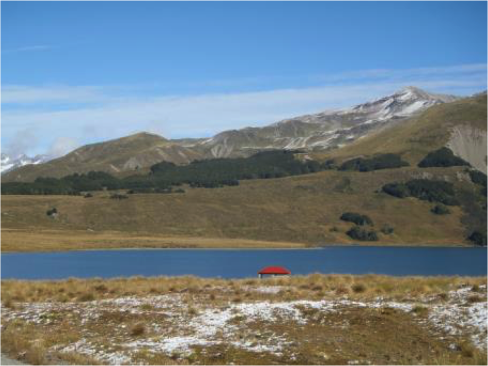
Lake Tennyson
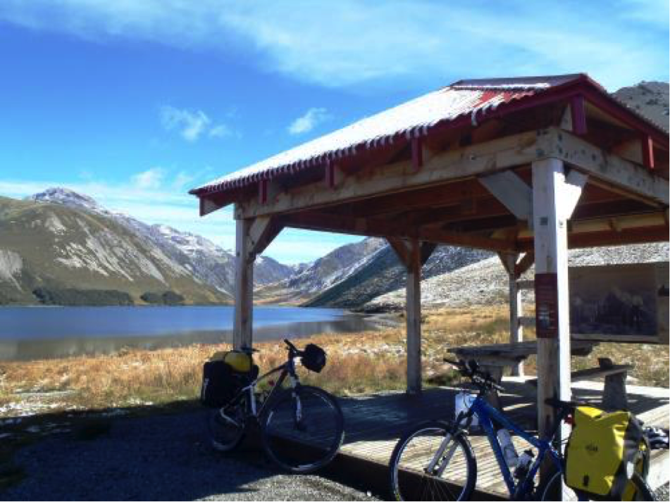
Lake Tennyson Shelter
We made a quick detour to the picture perfect campsite at Lake Tennyson then rode onward, accompanied by the Clarence River.
The only other time I had been down this road was racing hard-out in the Rainbow Rage, then with no time to think about how this was BIG country: beautiful, harsh, quiet, pristine. We made a stop for lunch at the St James Cycleway and a promise to return to ride it, before zipping straight past the turnoff to Jack’s Pass and Hanmer Springs, pushed nicely along by a tail breeze.
Eventually the whitewash of the historical Acheron Accommodation House came into view as we crossed the Clarence River. Being the only campers there we had the pick of the spots, which was under a large tree with views of the river, yet sheltered from the wind that had pushed us down the valley.
View to Clarence River and Acheron House
The sun was still warm and the river looked clean, cool and inviting. Swimming attire had been left at home so that left only one choice. It was hard to believe that this morning we had been riding through snow at the head of the Clarence and now, just a few hours later, we were happily swimming in it. We wondered who had been faster down the valley, the water in the river or us cycling…
The clear night, altitude and snow covered hills were perfect conditions for creating a good frost. We wore all that we had but with lightweight sleeping bags and a summer tent it was not the best night’s sleep. This is March, we shouldn’t be getting snow and frost!!!
It is 60km from Acheron House across the Molesworth to Cob Cottage but we had to ride at least 100kms to make up for the first days shortfall. We paid the weathered faced DOC ranger the fee then set off, or should I say up, as within a few strokes of the pedal a steep climb started. We encountered a number of campers and four wheel drivers but not a cyclist was to be seen as we headed north alongside the Acheron River.
It was sad looking down into the water and seeing the long, dense tentacles of didymo among the rocks. A large flock of geese, smart enough to avoid the whiskey drinking shooters, sailed passed.
The weather and wind stayed kind, my privates knew this was day three and were reminding me they didn’t like corrugated roads so we did our best to choose a smooth line. By this time we had been riding long enough to know that 15km per hour was our average.
An excellent DOC information signboard near Mount Augarde tells the sad story of how the mountain was named after Ivanhoe Augarde who killed himself after shooting “German Charlie”. Charlie had opened Ivanhoe’s private love letter to Miss Kate Gee and shared its content with various groups of men, who had then ridiculed Ivanhoe to a point of despair.
The climb over the 1,145m Ward pass could now be seen in the distance at the end of a long, straight, dusty road. As we rode we saw few rabbits but there were signs that many were still about. The climb over Ward Pass was short but very steep and extremely hot. Then suddenly with Mt Chisholm on our left, we were at the head of the vast Awatere Valley. Snow-capped Mt. Tapuae-O-Uenuku could be clearly seen off to the right. A lively herd of horses galloped in the paddock alongside us as we pedalled past the Molesworth Farm Station and Historic Cob Cottage. We followed the true left of the river but often climbed high as the road meandered north-east. As the evening drew near we found a spot beside a small river to camp for the night.
View from Ward Pass
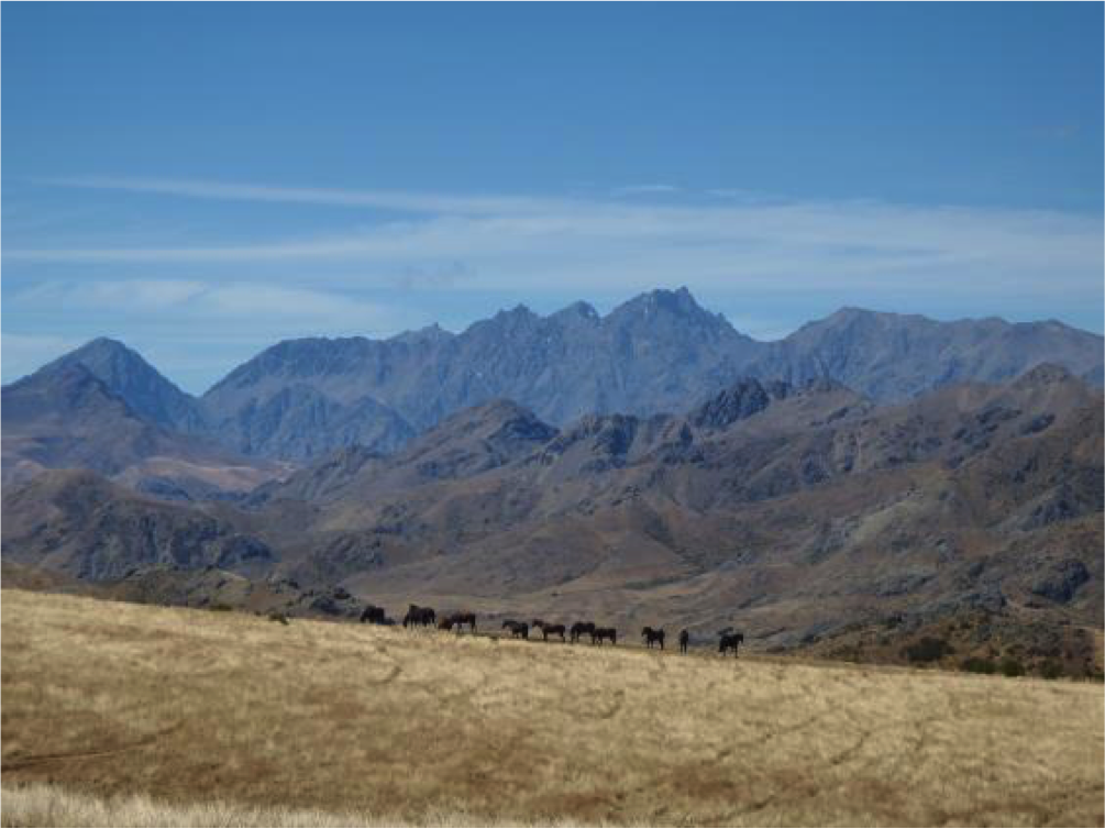
Horses on the Molesworth at the head of the Awatere Valley
Being awoken by heavy rain during the night was not ideal but come morning the sun reappeared. ‘Rollercoaster’ would be the best way to describe the terrain for the next few hours. Around midday a dark cloud appeared over Mt. Horrible to our left and promptly dumped a heavy shower of hard hitting hail as we descended to the valley floor. A nearby farm shed was an inviting prospect. It was not a good time for my ancient cooker to refuse to ignite. Or maybe it was, as we were in a fertiliser shed. Isn’t that what terrorists make bombs out of, we asked each other?
Wet and frozen we were relieved when the sun came out again! As we cycled on, the gravel road turned to seal, the tussock turned to grapes and the wind was at our backs. It was not long before we hit the turnoff that took us over Taylor Pass to Blenheim. Just as we crossed the pass the heavens opened yet again, this time accompanied by thunder and lightning. An hour later and drenched through, we made town and decided it was a good time to pay a visit to family who lived there. It was short of our planned target but the hot shower and meal we received was most welcome.
Day five was our return to St Arnaud up the Wairau Valley. Unfortunately the wind was not in our favour. It was a 40km per hour head wind for over 100km. There was only one way to ride: head down, focus on the road and keep to a rhythm. It seemed long; it was long. Eventually we passed the Rainbow Road where our journey had begun and we freewheeled down the last hill back to the van.
We took a selfie; we looked rough; we smiled. We live in BIG country.